| |
|
|
|
| |
LIDAR |
|
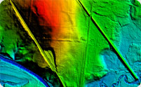
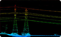
LIDAR (Light Detection and Ranging) is an optical remote sensing technology that combines laser light and positioning measurements to provide highly accurate digital elevation. It is a highly accurate and cost effective application, which generates accurate height data and intensity images using IMU and GPS data, enabling to model the earth's surface in detail.
We are providing LiDAR Data Processing from the raw point cloud and the output we provide are LAS, BIN and EBN file formats.
We are providing the following LIDAR services to our clients:
Bare earth classified digital terrain models
- Contour Mapping
- Lidargrammetry
- Corridor Survey.
- Volumetric Analysis.
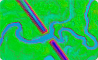
- Intensity images and contours generation.
- Flood plane mapping (with 3D break lines).
- Street 3D view extraction from Mobile lidar clouds.
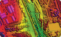
- Terrain extraction and Planimmetric feature classification.
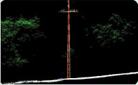
- Electric Tower Classification and Wire detection.
- Generation of elevation profiles, Digital Surface Models (DSM) and Digital Terrain Models (DTM) as raster, TIN, contour or slope models.
|
|